We have had a number of requests for directions/details on the operating sites so that hams and members of the public could see what a radio competition looks like. Many of the operating sites are on private land or have limited access. The sites below are easily accessible and staffed by site teams that are willing to speak with visitors.
Visiting times are
- Friday, July 11, between 1pm and 7pm
- Saturday, July 12, between 6am and 7pm
Please respect the competition. Do not interfere with the operators during the contest.
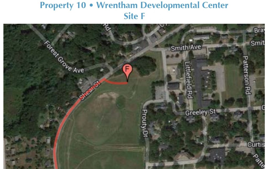
Wrentham, MA – Wrentham Development Center
This site is located on the west side of the complex along Shears St. Use 271 Shears St, Wrentham, MA 02093 for your navigation GPS.
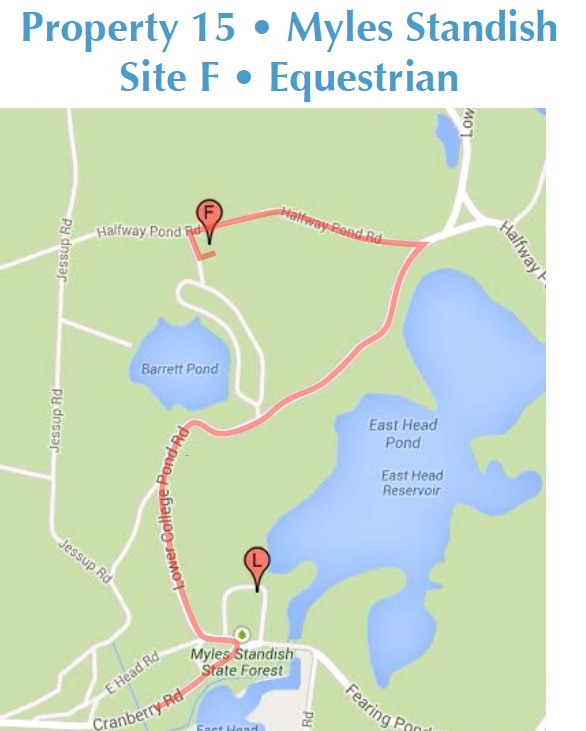
Myles Standish State Forest
This site is on an equestrian field north of Barrett Pond.
From West Entrance
When you arrive at the West Entrance on Cranberry Rd., continue on Cranberry Rd. for 1.3 mi (2.1 km). At the intersection turn left onto Lower College Pond Rd. At 0 .9 mi (1.4 km) there’s a sign for “Equestrian Parking Lot.” Make a sharp left onto this dirt road (Halfway Pond Rd.), follow for 0.4 mi (0.6 km) and turn left, passing the parking lot on your right. The entrance to the Equestrian field is on the left, shortly past this parking lot. The operating site is in the Equestrian field.
From East Entrance
Take Alden Rd. for 1.7 mi (2.7 km) and bear left at fork onto Upper College Pond Rd. Follow for 1.9 mi (3.0 km) to the intersection with Halfway Pond Rd. Take Halfway Pond Rd. towards the Headquarters for a little over 0.75 mi (1.2 km), bearing left at the intersection with Lower College Pond Rd. Immediately after the stop sign, turn right onto the dirt road (Halfway Pond Rd.), following the signs leading to the “Equestrian Parking Lot.” Follow for 0.4 mi (0.6 km) and turn left, passing the parking lot on your right. The entrance to the Equestrian field is on the left, shortly past the parking lot. The operating site is in the Equestrian field.
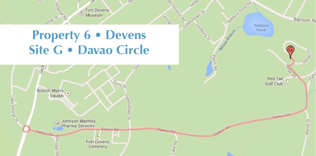
Devens – Davao Circle
This site is at an abandoned military housing area in Davao. From the property entrance on Jackson Road, turn right onto Patton Rd. and follow Patton Rd. for 1.6 mi (2.5 km). You will pass Johnson Matthey Pharma Services on your left, the entrance to the Federal Medical Center on your right and the Fort Devens Cemetery on your right. You will then be passing the entrance to Mirror Lake. At 1.6 mi (2.5 km) bear left at the intersection. Bear left at the next intersection (600 ft (200m)) and immediately after bear left again onto Bulge Rd. You will pass the entrance to the Red Tail Golf Club on your left. Turn right about 300 ft (100m) past the golf club entrance into Davao Circle. Turn left at the intersection and your operating site will be in the open field on the left side of the road.
There should be no traffic in this undeveloped area but be careful of hikers and bikers that may be there so drive slowly. Further up on Bulge Rd. is the club house for the Red Tail
Golf Club and a restaurant.
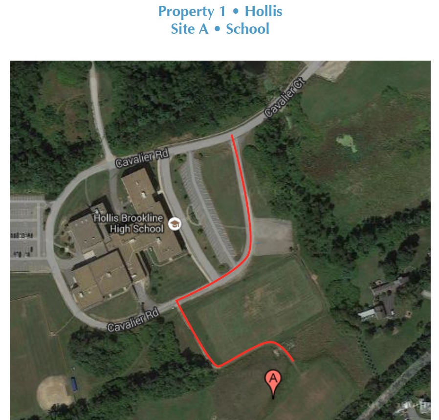
Hollis, NH – High School
This site is located to the left of the high school in an open field. Take a left on the intersection and follow the road around the high school. About 600 ft (200m) down the road (just past the soccer field) take a left onto an unpaved road. Follow the road around the soccer field and then to the edge of the football field. You will see the site on your left.


